Bear Mountain Topo Questions
Use your ESRT's, your knowledge of Earth Science, and the topographic maps of the Bear Mountain State Park area below. Click to enlarge the maps. Point values are shown/
|
Maps from http://www.digital-topo-maps.com/
|
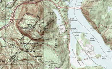
1. Which face of Bear Mountain has the steepest gradient?? (1pt)
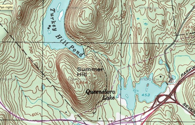
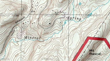
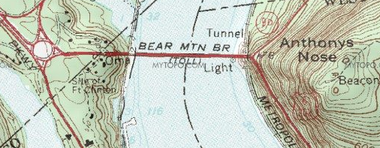
(A) SW (B) NE (C) SE (D) NW 2. According to the map, what is the highest elevation of Bear Mountain? (1pt) (A) 1200ft (B) 1264ft (C) 1299ft (D) 1300ft 3. Why does the road from Hessian Lake up to Perkins Memorial Tower (Near the summit) Curve around the mountain? (2pts) __________________________________________________ __________________________________________________ __________________________________________________ __________________________________________________ 4. Which body of water does the stream between Turkey Hill Pond And Queensboro Lake Flow into? Why? (2pt.) __________________________________________________ __________________________________________________ __________________________________________________ 6. Summer Hill is ____________ ft tall. (1pt) 7. What do the scattered black rectangles to the north of Mineral Spring represent? (1pt) _________________________________________________ 8. What is the gradient of Anthony's Nose? (1pt)
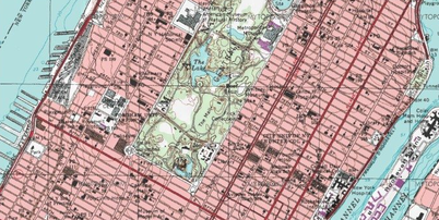
(A) No gradient (B) Low Gradient (C) High Gradient (D) Cliff 9. What is the elevation of Queensboro lake? (1pt) ___________ 10. How does the map below of Manhattan compare with the maps of the Bear Mountain Area? What geographical features are different? What is the elevation like? (3pts)
______________________________________________________ ______________________________________________________ ______________________________________________________ ______________________________________________________
11. Sketch a profile from the south-easternmost point in Turkey Hill Pond to the eastern edge of Queensboro Lake. (1pt)
12. Based on gradient, what is the flow-rate of mineral spring? (1)
(A) Fast (B) Slow (C) Waterfall (D) Not Moving |
